Products search
Menu
About Us
Vision / Values
Partners
MOSS Systems
Leica
Hexagon
SafeSight
Team
Recent News
Work With Us
Survey Solutions
Total Stations
Total Stations
Accessories
Controllers
Manual Total Stations
MultiStation
Robotic Total Stations
Software
Laser Scanners
Laser Scanners
Accessories
Scanners
Software
GNSS Systems
GNSS Systems
Accessories
Controllers
Receivers
Smart Antennas
Software
Detection Systems
Detection Systems
Cable Locators
Concrete Scanner C-Thrue
Software
Utility Detection Radar
Lasers
Lasers
Accessories
Pipe Lasers
Rotating Lasers
Upgradeable Lasers
Disto & Lino
Disto & Lino
Accessories
Apps
Leica 3D Disto
Leica Disto
Leica Disto Packages
Leica Lino Line & Point Lasers
GIS Collectors
GIS Collectors
GIS Handhelds & Tablets
GIS Software
Smart Antennas
3D Imagers
3D Imagers
BLK3D
Levels
Levels
Accessories
Automatic Levels
Digital Levels
Survey Supplies
VIEW ALL
Full Catalogue
Mining Solutions
Monopod & Wall Mount System
Hexagon
HxGN MineOperate
MineOperate Reverse Assist
Split for Fragmentation Analysis
Fleet Management
Machine Guidance
Machine & Asset Health
HxGN MineProtect
Collision Avoidance
PPA
Operator Alertness System (OAS)
Tracking Radar
Vehicle Intervention System
HxGN MinePlan
Geology Suite
Engineering Suite
Production Suite
Standalone Planning Tools
HxGN MineEnterprise
CAS Analytics
MineEnterprise Modules
MineEnterprise Platform
HxGN MineMonitoring
Critical Slope Monitoring
Focused Slope Monitoring
Rockfall hazard detection
Data Aggregation
Strategic Long-term Monitoring
Support and Services
Leica Geosystems
Leica Mine Survey Solutions
Leica Accessories Catalogue
Multistations & Total Stations
Software
GNSS
Controllers
Levels
Lasers
Leica Mine Monitoring
MOSS
SafeSight
SafeSight Products
Deeptraax
DB3
SafeScout
SafeCam Mini
SafeCam
Services & Support
Product Services
Customer Support Services
HxGN SmartNet
Contact Us
Home
>
Leica Geosystems
>
Levels
>
Digital Levels
Follow
Follow
Follow
Total Stations
None
Leica Geosystems
Accessories
Bags & Containers
Soft Bags & Back Packs
Hard-Top Cases
Accessories
Batteries (Chargers & Cables)
Carriers
Data Transfer Cables
Level & Field Books
Lenses
Levelling Staffs
Marking (paint and tape)
Measuring Wheels & Tapes
Memory
Paint Poles & Sticks
Plumb Bobs
Replacement Cord & Gammon Reels
Prisms & Reflectors
Standard
Special
Mini
Prism & GNSS Poles
Extended Antennas
Scales
Safety Wear
Targets
Tribrachs
Tripods
Wall Mount Prisms / Monopods System
Detection Radar
Software
Utility Radar Detection
Cable Locators
Concrete Scanner C-Thrue
Accessories
Total Stations
Systems
MultiStation
Controllers
Manual Total Stations
Software
Robotic Total Stations
Laser Scanners
Accessories
Software
Scanners
GNSS Systems
Smart Antennas
Software
Receivers
Controllers
GNSS Accessories
Lasers
Upgradeable Lasers
Rotating Lasers
Pipe Lasers
Accessories
Levels
Automatic Levels
Digital Levels
GIS Collectors
GIS Software
GIS Handhelds & Tablets
Smart Antennas
Disto & Lino
Leica Disto
Leica 3D Disto
Leica Lino Line & Point Lasers
Leica Disto Packages
Apps
3D Imagers
BLK3D
Total Station Accessories
Mining Solutions
Hexagon
HxGN MineOperate
HxGN MineMonitoring
Critical Slope Monitoring
Focused Slope Monitoring
Rockfall hazard detection
Data Aggregation
Support and Services
Leica Geosystems
Leica Mine Survey Solutions
Multistations & Total Stations
Software
GNSS
Controllers
Levels
Lasers
Leica Mine Monitoring
Portfolios
Show only products on sale
In stock only
Quickview
Leica Sprinter 50
Category
Leica Geosystems
,
Digital Levels
Easy handling Improve the quality of your daily measuring tasks. Get the results simply by the push of a button. The one-button level is easy to use also without specific instructions or trainings. Glaring sun shine or rain does not stop the Leica Sprinter 50 as it is dust and jet-water protected (protection class IP 55). The results can be read-out from the highly visible LCD even in unfavourable light conditions. Reliable and error free measurements Avoiding expensive measuring errors can save you a lot of money. The build-in tilt sensor of the Leica Sprinter 50 prevents the system from measuring if you operate outside the compensator range. Due to this safety check, you can be sure to get always accurate results.
Quickview
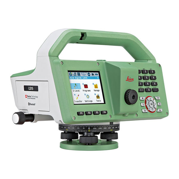
LS10 & LS15 Digital Levels
Category
Leica Geosystems
,
Digital Levels
,
Leica Geosystems
,
Levels
For trusted surveyors and measuring professionals, getting a full day’s worth of highly precise levelling measurements is not only stressful but an unusually complex and redundant job. Leica LS15 and LS10 digital levels give a welcome chance to alleviate demanding levelling tasks. Automated functions and industry-leading 0.2mm accuracy allow users to easily demonstrate their measuring skills while effectively completing any project. From autofocus to touchscreen displays with clean layouts, the entire measurement process is made more efficient with LS15 and LS10 digital levels. Common levelling errors, like misreading the staff or transcription mistakes, are worries of the past. Providing the most reliable results from immediately understandable line flows with image-supported colour visuals, these levelling solutions make the professional’s daily tasks a more enjoyable experience. Users profit from Leica Geosystems’ experience as inventors and industry leaders of digital levels. Honing the digital level into an art form, these solutions collect results faster with the
Quickview
Sprinter 150 Digital Level
Category
Leica Geosystems
,
Digital Levels
High efficiency with precise calculations Improve your efficiency with the automatic calculations of the Leica Sprinter 150 for delta height and tracking & monitoring. The digital level covers almost all construction applications such as cut & fill, line levelling and distance measurement. For continuous measurement choose the tracking and averaging mode for even more accurate results. Convenient handling – multiple languages Does your crew speak different languages? The Leica Sprinter is the only instrument of its class with multiple languages on-board. This allows you to choose the preferred language – simply and with only one keystroke, for improved efficiency and convenience. Downloads Leica Sprinter Brochure Leica Sprinter Technical Data Leica Sprinter 50,150,150M,250M Declaration of Conformity Leica Construction Catalogue
Quickview
Sprinter 250M & 150M Digital Levels
Category
Leica Geosystems
,
Digital Levels
,
Levels
Improved workflow and high productivity Avoid transcription errors and improve your workflow. Store up to 2,000 measurements and download them to your personal computer via USB Interface. The Sprinter DataLoader enables a smooth data transfer to Microsoft Excel. Your measurements can also be transferred to an external data collector via RS232 interface. High Application Flexibility Be prepared for all type of construction levelling tasks with the automatic calculation programs of the Leica Sprinter M. The programs for: Delta Height Calculates the height difference between points. Enter your benchmark, measure your backsight and then your various targets (foresights) for accurate calculations. The delta height is always calculated and clearly displayed. Line Levelling Whether you only have back and foresights or even intermediate sights, choose the line levelling job you need. Enter your starting benchmark, measure your backsights, intermediate sights and foresights until you have reached your final point. All measurements are stored in the appropriate and convenient order. Cut