Improve efficiency
The Leica ZRover FieldGenius is intuitive and easy-to-use, allowing you to carry out multiple tasks on one device. Locate, measure, record and share GIS information more accurately, as well as carry out your daily surveying tasks, all on one device.
Increase productivity
FieldGenius is an easy-to-use data collection software application for surveying & GIS tasks. With stake out commands for points, lines, arcs, alignments and 3D surfaces, the ZRover FieldGenius includes all staking tools you need to complete your daily tasks more efficiently and thus increase productivity.
Improve data accuracy
When collecting survey & GIS data, the ZRover FieldGenius provides reliable positional accuracy of up to one centimetre in real-time, improving the accuracy and reliability of your data.
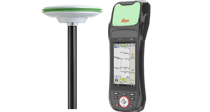
Leica AS10 – Multi-GNSS Triple Frequency Antenna
Light weight and well balanced, the passive Leica AS10 antenna on top of the precision pole benefits from enhanced signal quality and requires no additional batteries.
Leica Zeno 20
The Leica Zeno 20 provides fast and reliable data in the field. Rugged to withstand the elements of any work site, the Zeno 20 comes with a durable IP67 dust and waterproof rating.
FieldGenius Software
By using the FieldGenius software you improve the ease and speed of your survey data collection with the ability to stake out points, lines, arcs, alignments and 3D surfaces, the ZRover FieldGenius software contains all the staking tools you need to complete your daily tasks.
HxGN SmartNet
HxGN SmartNet transforms the world’s largest reference network into a precise positioning service. Connect the ZRover FieldGenius to HxGN SmartNet GNSS correction services and enable up-to one centimetre positioning in real-time, allowing for faster and more accurate data collection in the field.
To learn more about digital asset management, download the e-book